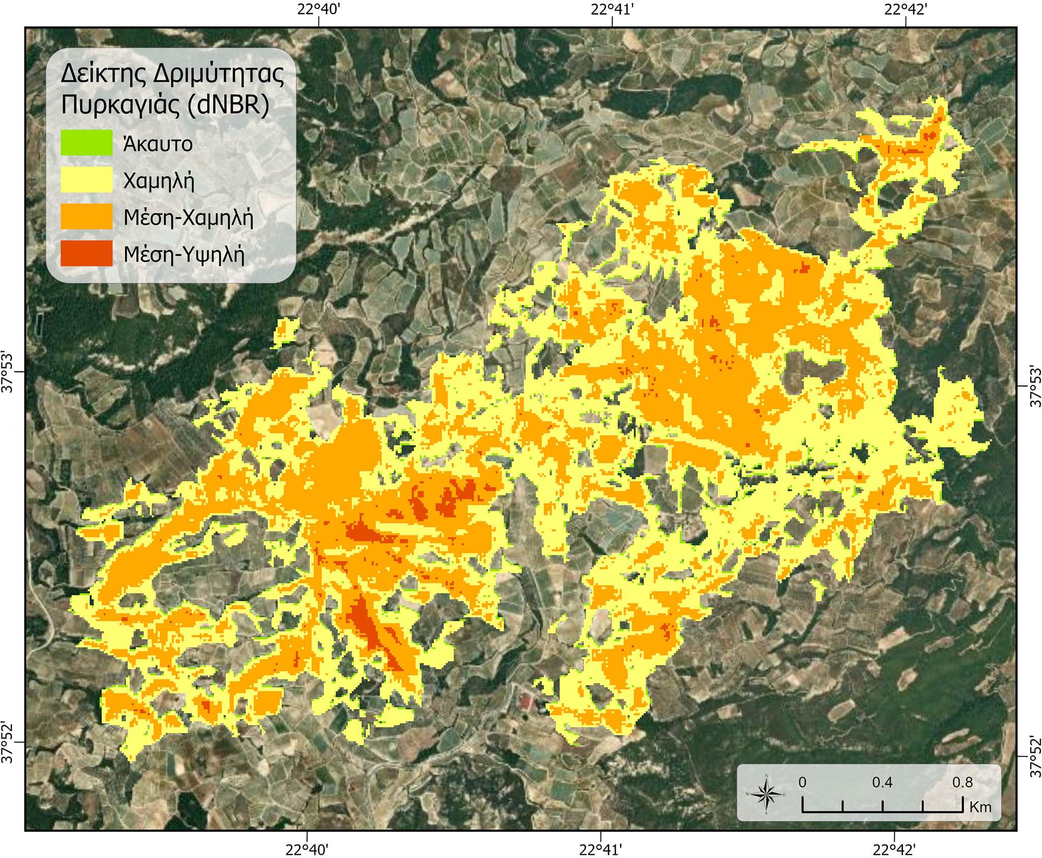
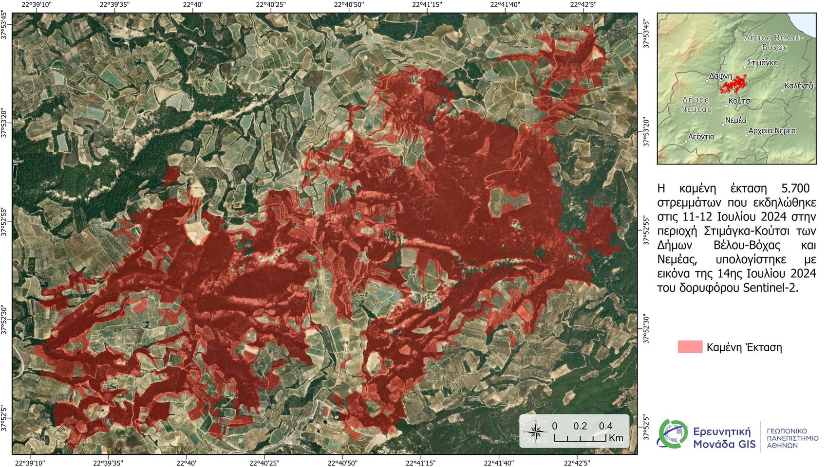
GIS aua

Initial satellite estimates for the burned area from the fire in the Nemea region.

First satellite estimates for the burned area from the fire that occurred on July 11th and 12th, 2024, in the Nemea region.
A satellite image (Sentinel-2) taken on the afternoon of July 13th, 2024, was used, and the data processing was carried out by members of the GIS Research Unit of the Agricultural University of Athens (GPA).

#gis #satelite #fire #firesafety

More news

Cover Story in Hydrology: The Latest Publication from the GIS Research Unit
Διαβάστε Περισσότερα
Digital Systems for Sustainable Agricultural Development | AgroThessaly 2025
Διαβάστε Περισσότερα
Accredited Training Program for Secondary Education Teachers
Διαβάστε Περισσότερα
Εθνικό Πρόγραμμα Μικροδορυφόρων: "Ανάπτυξη εθνικού δικτύου IoT συλλογής δεδομένων εδαφικής υγρασίας"
Διαβάστε Περισσότερα
Accredited Training Program by the Agricultural University of Athens
Διαβάστε Περισσότερα
Participatory Workshop of the Path4Med Research Project
Διαβάστε Περισσότερα
Scientific publication of the Research Unit
Διαβάστε Περισσότερα
Visit of members of the GIS Research Unit to the Public University of Navarre (UPNA).
Διαβάστε Περισσότερα