Schinos, Corinth - Burned Area Assessment
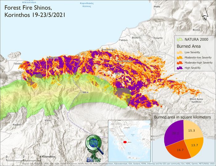
The fire (19-21/5/2021) in Schinos, Corinth, burned 65,900 hectares according to the calculations of the GIS Research Unit of the Agricultural University of Athens.
The calculations were based on Sentinel-2 satellite images. By calculating the dNBR (difference Normalized Burn Ratio) index and applying the methodology of the U.S. Geological Survey, a "burn severity map" was created. This map allows for the spatial estimation of not only the severity of the damage but also the potential future risks of flooding, landslides, and soil erosion.
More news
LATEST NEWS
13/12/2025
1 month ago
gisaua
17/11/2025
2 months ago
gisaua
31/10/2025
2 months ago
gisaua
No posts found


