Pendelis 2022 – Estimation of Burned Area and Fire Intensity Based on Satellite Images.
Pendelis 2022 – Estimation of Burned Area and Fire Intensity Based on Satellite Images.
Penteli 2022 – Estimation of Burned Area and Fire Intensity.
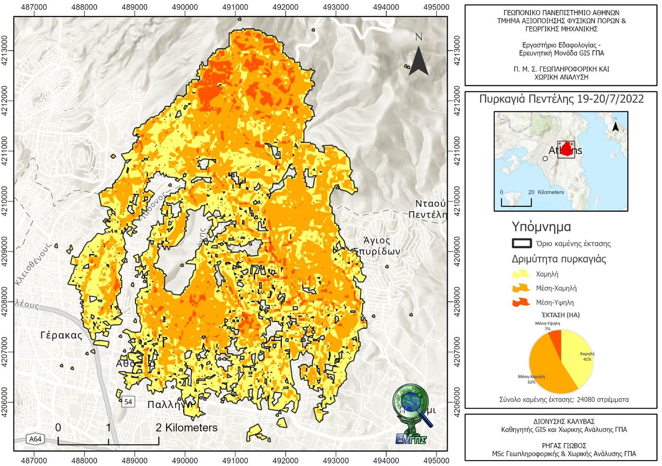
The fire that started on the afternoon of Tuesday, July 19, in the area of Daou Pentelis burned 24,080 acres, according to calculations by the GIS Research Unit of the Agricultural University of Athens.
The calculations were based on Sentinel 2 satellite images.
By calculating the dNBR (difference Normalized Burn Ratio) index and adapting the methodology of the United States Geological Survey, the intensity of the fire was mapped. This allows for the spatial estimation of not only the severity of the damage but also the potential for future impacts from floods, landslides, and soil erosion.