GIS aua

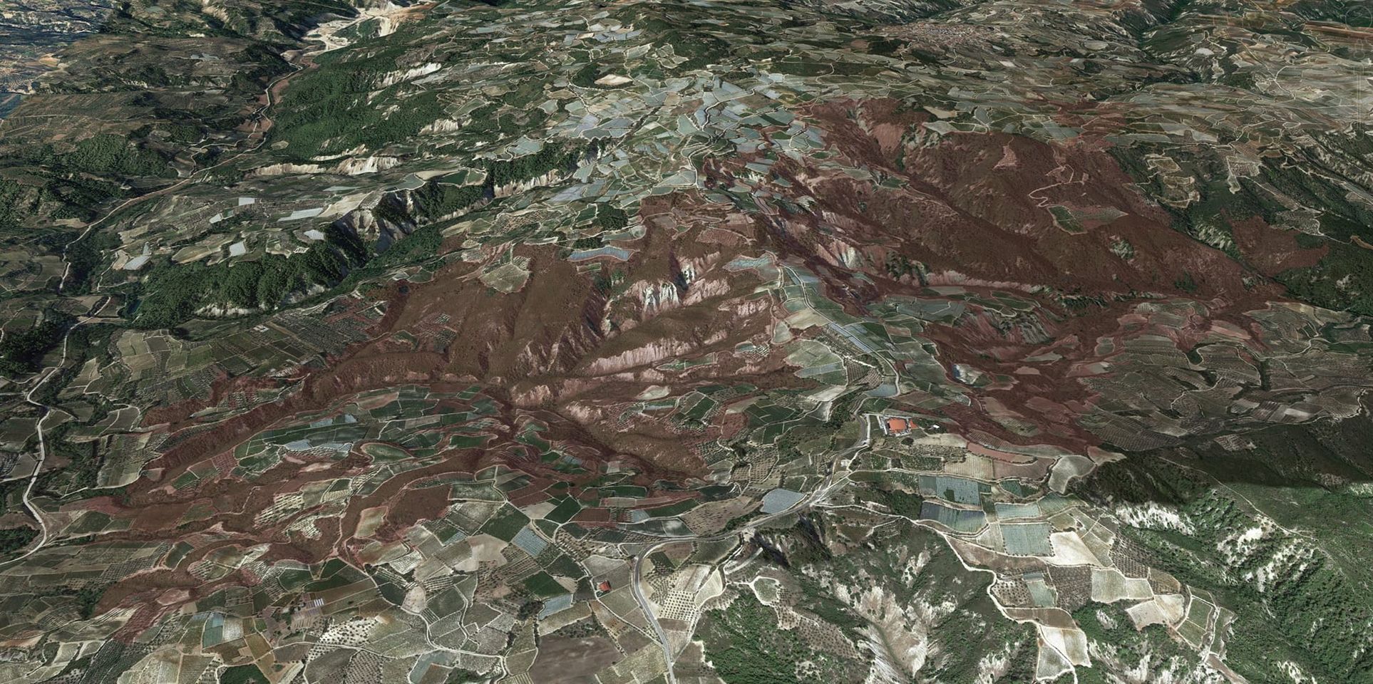
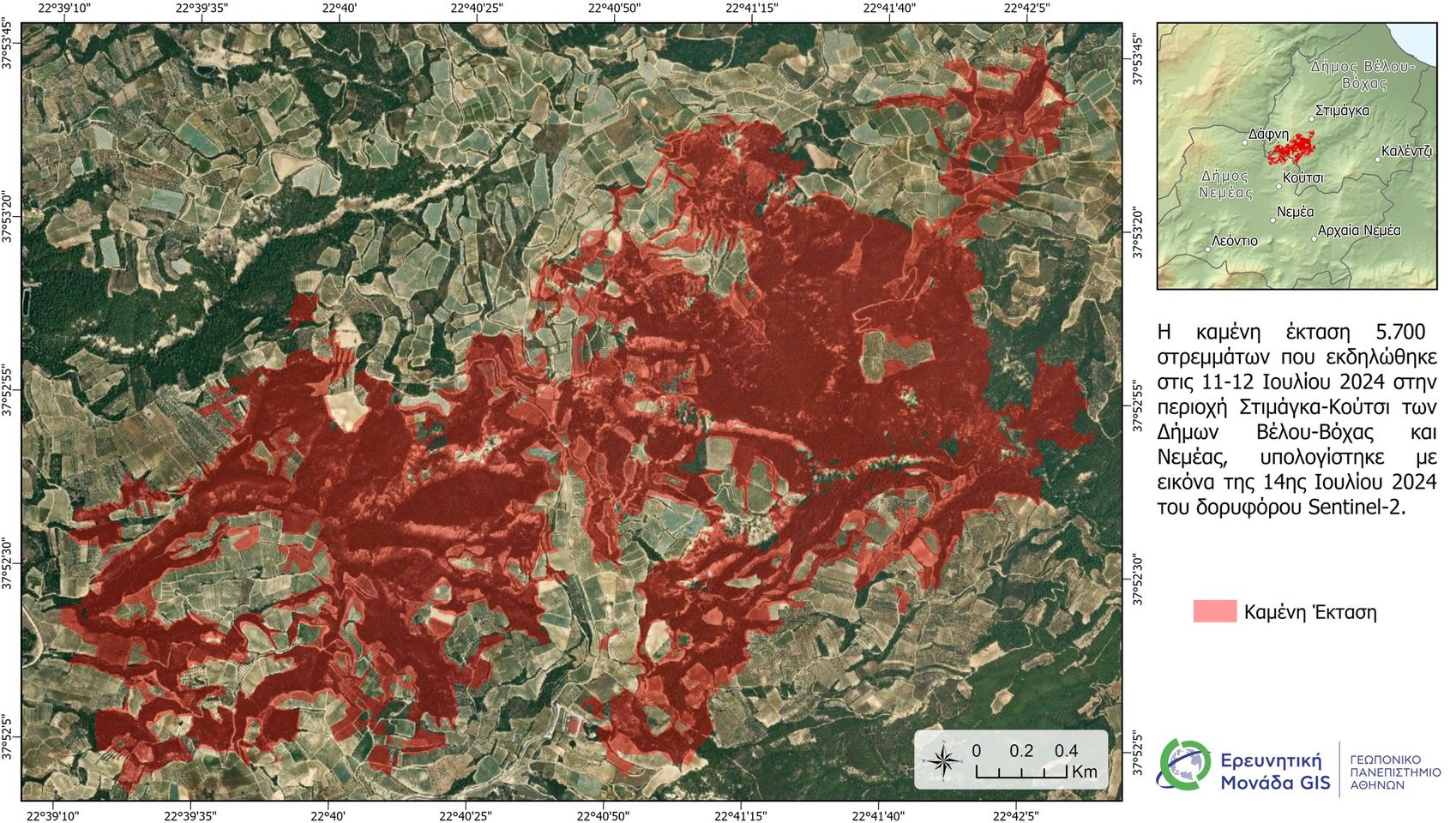
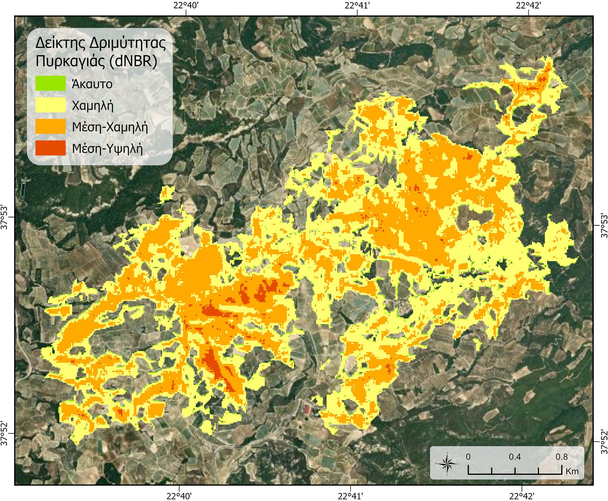
Initial satellite estimates for the burned area from the fire in the Nemea region.

First satellite estimates for the burned area from the fire that occurred on July 11th and 12th, 2024, in the Nemea region.
A satellite image (Sentinel-2) taken on the afternoon of July 13th, 2024, was used, and the data processing was carried out by members of the GIS Research Unit of the Agricultural University of Athens (GPA).

#gis #satelite #fire #firesafety

More news

Ψηφιοποίηση εδαφολογικών μελετών περιοχών εντός των διοικητικών ορίων της Περιφέρειας Πελοποννήσου
Διαβάστε Περισσότερα
Participation in the 15th International Workshop on Statistical Hydrology and Ground Water (STAHY-ICGW 2026)
Διαβάστε Περισσότερα
I-TexGEO: Έξυπνο έδαφος για τη γεωργία του αύριο - Νέο πρόγραμμα HORIZON
Διαβάστε Περισσότερα
New Operational Surface Soil Moisture Estimation Service Developed by the GIS Research Unit of the Agricultural University of Athens under the National Microsatellites Programme
Διαβάστε Περισσότερα
2nd Participatory Workshop of the Path4Med Research Project
Διαβάστε Περισσότερα
Post-Event Press Release
Διαβάστε Περισσότερα
Free 3 Day Worskhop
Διαβάστε Περισσότερα
Participation in Agrotica 2026
Διαβάστε Περισσότερα