The Remote Sensing and GIS Laboratory of the Agricultural University of Athens (AUA) has been actively supporting the dissemination of new geospatial digital technologies and has designed and implemented a series of organized professional education and training programs continuously since 1990. The trainees include a diverse range of participants, such as students, graduates, professionals, farmers, and cultivators from both Greece and abroad. These programs are funded by state agencies, research initiatives, businesses, scientific and professional associations, with several also being self-funded. Today, these programs are offered through AUA's Center for Lifelong Learning and Continuing Education (K.E.DI.VI.M.).
Today these programs are carried out through the Center for Education and Lifelong Learning (K.E.DI.VI.M.) of the Greek Academy of Sciences.
-
KEDIVIM G.P.A.
-
COST seminar 19-22 June 2023
-
NEW AGRICULTURE NEW GENERATION - Barba Stathis
-
M.O.D. DEVELOPMENT PROGRAMS
-
AdaptNet – Digital Agriculture
-
WEED MAPPING
The GIS Research Unit designed and implemented skill upgrading and retraining programs in high-demand sectors, with an emphasis on digital and green skills. Specifically, it conducted the following programs from September 2022 to December 2022:
- Location Intelligence and digital geospatial technologies: GIS, Drones, Satellite Images
- Geographic Information Systems (GIS), geospatial technologies, and Location Intelligence in environmental and forest management
- Geographic Information Systems (GIS), geospatial technologies, and Location Intelligence in Digital Agriculture
B. Geoinformatics and digital geospatial technologies in agriculture for environmental protection
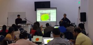
C. Processing digital image data from UAVs: GIS, remote sensing, 3D models, multispectral and thermal data, Vegetation indices
D. Basic training for UAV operators: Acquisition of A1/A2/A3 certification
E. Environmental Education for Preschool and Primary Education Teachers (Theory and Practice)
Training School in Unmanned Aerial Systems (UAS) in Agriculture: Applications in Vineyards [Cost Action CA21134 (T0P-AGRI-Network)]
This Training School has been organized by the scientific team of GIS Research Unit of Agricultural University of Athens and took place in selected awarded wineries of the internationally renowned Nemea PDO vineyard region. In this region a geospatial observatory has been established by the AUA GIS Research Unit as one of the results of a four year research project.
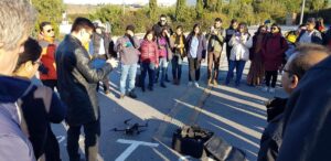
The course has been provided the principles and essential knowledge required for safe operations of state-of-the-art Unmanned Aerial Vehicles for agricultural applications mainly focused on vineyard management and pest detection. The course has been included meeting with pre-flight procedures and calibrations, development of basic flight skills in real flight conditions, use of a wide range of sensors for drone-based multispectral data acquisition for a variety of agricultural applications, and practice with open- source photogrammetric software for flight planning and post-flight processing of aerial imagery data.
18-24 November 2021
The GIS Research Unit undertook (as part of the implementation by the company NEW AGRICULTURE NEW GENERATION of a training program for the Agricultural Directorate of the Barba Stathis Company) the provision of demonstration services in the use of new technological aerial means and familiarization with precision agriculture services through educational seminars. Specifically:
I. Real-time demonstration of autonomous aerial multicopter flight with image capture in the visible region of the Electromagnetic Spectrum (EM spectrum).
II. Real-time demonstration of autonomous aerial multicopter flight with simultaneous image capture in the near-infrared region of the EM spectrum.
III. Processing and display of images for the rapid observation of the total cultivated area in order to monitor plant growth, harvest planning, forecast production and diagnose issues related to nutrition, pest infestations, and plant diseases in a timely manner so these problems can be addressed promptly, before their effects manifest on the cultivated plants.
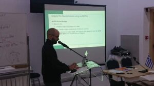
Training on the Use of Geographic Information Systems (GIS) through two cycles of seminars/webinars (1/6/2021-28/2/2022) for officials of the Special Managing and Implementing Services of the "Rural Development Program 2014-2020" .
The objective was to train twenty-five (25) staff members of the Special Management Service and the Special Implementation Service of the "Rural Development Program." These staff members are responsible for analyzing and presenting data and information with a spatial dimension, necessitating the use of Geographic Information Systems (GIS) environments.
The contracting authority of the project was the DEVELOPMENT PROGRAM MANAGEMENT ORGANIZATION UNIT (M.O.D.) S.A.
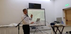
he GIS Research Unit undertook the implementation of part of Workshop 3, "Climate Change and Agriculture," within the framework of AdaptNet. The event took place at the "Navarino Environmental Observatory" in Pylos, from February 3–8, 2020. Specifically, the GIS Research Unit team, under the scientific supervision of Mr. Dionysios Kalivas, presented the full spectrum of modern digital technologies in agriculture in both theoretical and practical ways. The presentations, under the general title "Digital Agriculture - Demonstration of digital tools, software, and hardware (GIS, Remote Sensing, UAV, Mobile Applications) for site-specific crop and soil management (irrigation, fertilization, pest control)", included the following thematic units:
- Site Specific Digital Agriculture
- Spatial analysis of satellite data and GIS tools Management and monitoring zones using vegetation index Exploratory Spatial Data Analysis
- Spatial analysis of satellite data and GIS tools Management and monitoring zones using vegetation index Exploratory Spatial Data Analysis
- Cultivation and Monitoring using Remote Sensing: Applications in Agriculture
The GIS Research Unit participated over the past decade in the organization of workshops and summer schools of the "Weed Mapping Working Group" under the European Weed Research Association (EWRS). Specifically, the unit contributed to two workshops in Prague (2014, 2018), in Israel (2015), and in Chania (MAICh, 2019), presenting theoretical topics and organizing the practical training and exercises for participants in the following areas:
- Statistical methods and analysis for the spatial and non-spatial distribution of plant species using geostatistics
- Creation of digital maps for weed distribution, analysis, and interpretation of the maps
- Use of digital mapping in the application of precision methods for weed management

