CROP MONITORING WITH VEGETATION INDICES – NDVI app
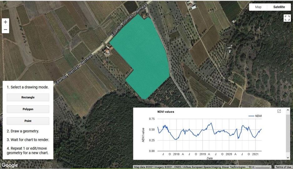
The GIS Research Unit of the Agricultural University of Athens has developed an application for monitoring vegetation growth in the vineyards of Nemea. The application was developed on the Google Earth platform and uses Sentinel 2 images.
The NDVI vegetation index is calculated from the satellite images for any area or specific vineyard in the Nemea wine-growing region (OPAP Nemea zone) from April 2017 to the present. These values are gathered into a chart and can be stored in table format for further analysis.
The application is very user-friendly and will soon be available to those involved in the viticulture and winemaking sector in Nemea.