Post-Event Press Release
6th Conference on Geographic Information Systems (GIS) and Spatial Analysis in Agriculture and the Environment
A landmark event showcasing scientific excellence, innovation, and collaboration
The 6th Conference on Geographic Information Systems (GIS) and Spatial Analysis in Agriculture and the Environment successfully concluded after three days of scientific exchange, innovation, and networking, held from 19 to 21 May 2026 at the Conference Amphitheatre of the Agricultural University of Athens (AUA). Running in parallel, the 3rd GISCongressEXPO took place at the University's Agricultural Museum, bringing together academia, industry, and public-sector stakeholders. 6ου Συνεδρίου Γεωγραφικών Πληροφοριακών Συστημάτων (GIS) και Χωρικής Ανάλυσης στη Γεωργία και το Περιβάλλον, που πραγματοποιήθηκε από τις 19 έως τις 21 Μαΐου 2026 στο Συνεδριακό Αμφιθέατρο του Γεωπονικού Πανεπιστημίου Αθηνών, ενώ παράλληλα φιλοξενήθηκε η 3η GISCongressEXPO στον χώρο του Γεωργικού Μουσείου του ΓΠΑ.
Το Συνέδριο, που διοργανώθηκε από την Ερευνητική Μονάδα GIS Organised by the GIS Research Unit of the Agricultural University of Athens in collaboration with Hellas GIS, the conference highlighted the growing importance of geospatial technologies in precision agriculture, environmental monitoring, natural resource management, and climate adaptation.Hellas GIS), εξελίχθηκε σε ένα δυναμικό τριήμερο επιστήμης, τεχνολογίας, εκπαίδευσης και δικτύωσης, επιβεβαιώνοντας τον καθοριστικό ρόλο των γεωχωρικών τεχνολογιών στη σύγχρονη γεωργία, στη διαχείριση φυσικών πόρων και στην προσαρμογή στην κλιματική αλλαγή.
More than a conventional scientific conference, the 6th GIS Congress served as a multidisciplinary platform for knowledge exchange, innovation, and collaboration, featuring:
More than 57 scientific presentations, Special thematic sessions and panel discussions, Seven hands-on technical workshops, A technology exhibition, Awards for outstanding undergraduate and postgraduate theses, Graduation ceremonies, Networking activities, including the first Geoinformatics Alumni Reunion.
More than 57 scientific papers (45 oral presentations and 12 posters) were presented by researchers from universities, research institutes, public organisations, and private companies from Greece and abroad. Topics ranged from remote sensing, photogrammetry, and precision agriculture to artificial intelligence, digital soil science, hydrology, biodiversity, natural hazard management, and environmental monitoring.
Particular interest was generated by presentations demonstrating the practical use of geospatial data, artificial intelligence, machine learning, drones, and WebGIS technologies in real agricultural applications. These included crop monitoring using vegetation indices such as NDVI, precision viticulture, olive grove and olive fruit fly management systems, water stress assessment tools, and UAV-based 3D photogrammetric mapping.
The conference hosted three high-level panel discussions focusing on:
The National Microsatellites Programme, highlighting the strategic importance of satellite Earth Observation data for monitoring agriculture, water resources, soils, and the environment, while supporting the development of modern geospatial infrastructures and operational services.
The Hellenic GeoSpatial Soil Data Hub, addressing the creation of a National Geospatial Soil Information Database and its contribution to precision agriculture, sustainable land management, and the implementation of the forthcoming European Soil Monitoring legislation.
Digital Geospatial Platforms, showcasing the latest developments in drones, WebGIS technologies, and artificial intelligence applications for agriculture.
Hands-on Workshops A strong emphasis was placed on practical training through seven specialised workshops covering: GeoAI applications, Google Earth Engine, Spatial modelling, Geospatial data analysis using R, Drone photogrammetry, WebGIS application development, Land evaluation using GIS, digital twins, and ecosystem services assessment.
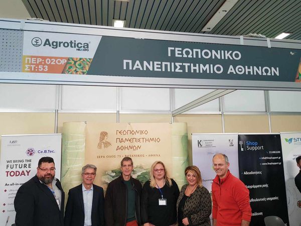
The 3η GISCongressEXPO The 3rd GISCongressEXPO provided a meeting point between research and industry, presenting precision agriculture technologies, geospatial platforms, smart irrigation systems, data analytics solutions, and digital services for the agri-food sector. The exhibition highlighted the strong collaboration between universities, research groups, technology companies, agronomists, and agricultural stakeholders. The conference was supported by 27 sponsors, with 13 exhibitors participating in the EXPO. GIS Congress EXPO.
One of the highlights of the conference was the honorary award presented to Professor Emeritus Nikolaos Giasoglou of the Agricultural University of Athens in recognition of his outstanding contribution to Soil Science, particularly in Soil Mapping and Land Evaluation.
The conference also celebrated young researchers through the Best Undergraduate Thesis Award and Best Postgraduate Thesis Award, organised by the GIS Research Unit to promote excellence in geospatial research.
The Best Undergraduate Thesis Award, dedicated to the memory of Professor Emerita Vasiliki Kollia, was presented to Maria Biza for her thesis:
"Species Distribution Modelling Using Remote Sensing and Geographic Information Systems: A Case Study of Canis lupus Distribution in the Antichasia Mountains."
The Best Postgraduate Thesis Award, also dedicated to the memory of Professor Emerita Vasiliki Kollia, was presented to Aliki Dourountaki for her thesis:
"Promoting the Ceramic Heritage of Aegina Through a Landscape-Based Approach."
These awards demonstrated the interdisciplinary nature of GIS and spatial analysis, with applications extending beyond agriculture and environmental sciences to cultural heritage and landscape studies.
The conference also hosted the first Geoinformatics Alumni Reunion, while graduates of the AUA Centre for Lifelong Learning (KEDIVIM) programmes organised by the GIS Research Unit received their certificates, further strengthening the educational dimension of the event.
According to the Conference Chair, Professor Dionysios Kalivas, geospatial information and digital technologies have become essential infrastructure for a more competitive, sustainable, and resilient agricultural sector. He emphasised that the real challenge lies not only in generating data but in transforming them into actionable knowledge for farmers, agronomists, public authorities, and society.
The 6th GIS Congress confirmed that Greece has developed a mature and dynamic geospatial community with strong scientific expertise, applied innovation, and close collaboration with the needs of agriculture, environmental management, and society.
Looking to the future, the conference reinforced the message that precision agriculture, smart natural resource management, and environmental monitoring increasingly rely on geospatial data. Transforming data into knowledge—and knowledge into action—remains a cornerstone of the digital transition in agriculture and environmental management.
The entire conference was recorded, and all presentations and special sessions are available on our YouTube channel.
A complete photogallery from the conference is also available.