Final assessments by the GIS Research Unit regarding the burned area of the wildfire in the Stimanga-Koutsi regions, based on satellite image analysis
Final assessments by the GIS Research Unit regarding the burned area of the wildfire in the Stimanga-Koutsi regions, based on satellite image analysis.
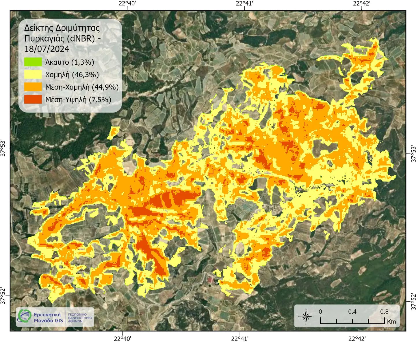
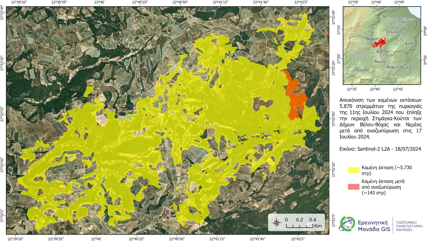
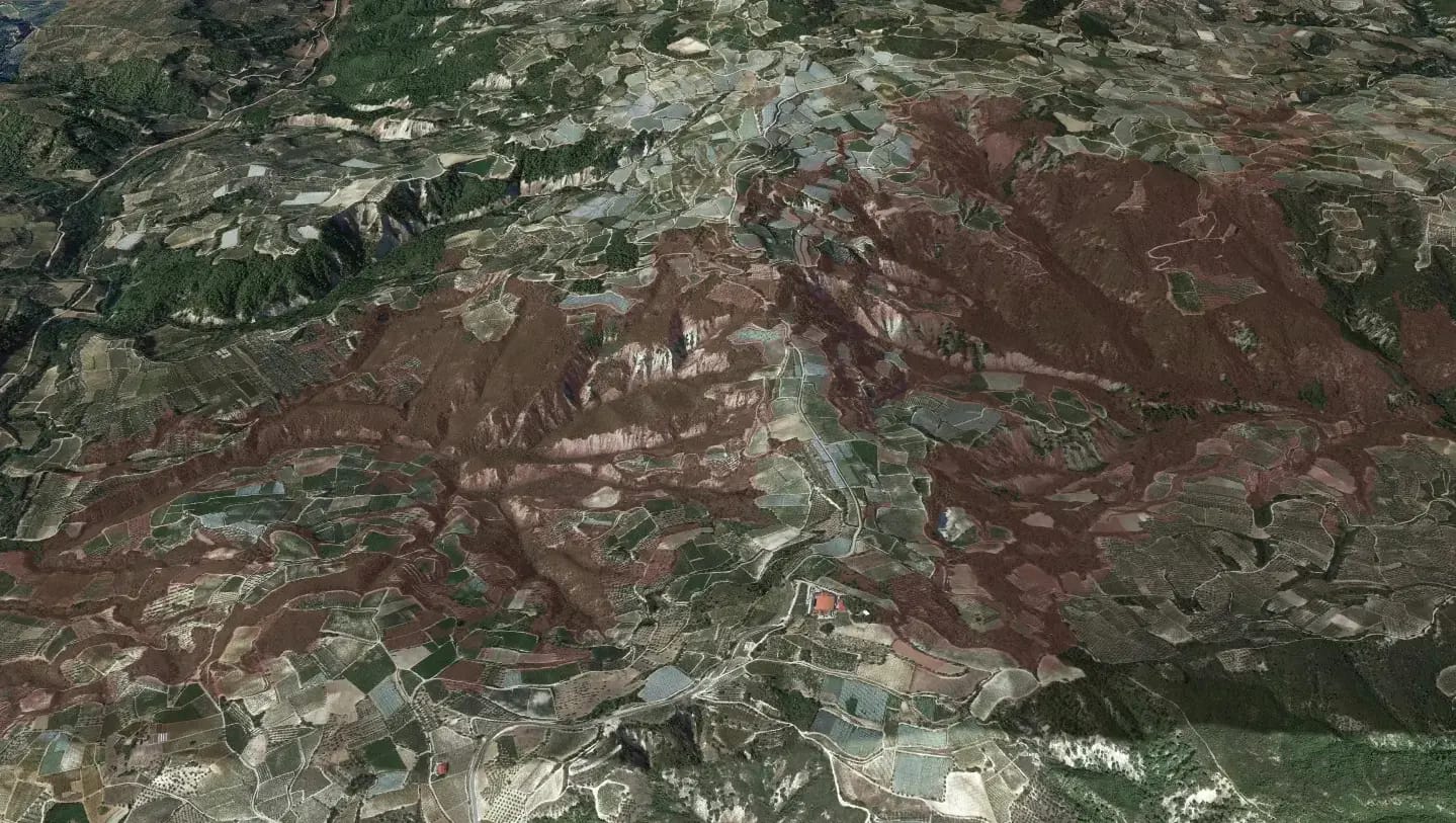
Final assessments by the GIS Research Unit of the Agricultural University of Athens (Sentinel-2 L2A satellite images – 18/07/2022) for the wildfire in the Stimanga-Koutsi areas (11-13 July 2024) and its re-ignition towards Chalki on 16 July.
Final burned area: 5,870 hectares.
The processing of satellite data in a GIS environment, combined with data from OSD (2022), determined that 523 hectares of vineyards were burned (of which 144 hectares were raisins) and 513 hectares of olive groves.