With the research carried out by departments of the Agricultural University of Athens, led by Professor Dionysios Kalyvas, in the Nemea vineyard, it is expected that in the near future, the balance in both the cultivation zone of the area and other zones and crops will change.
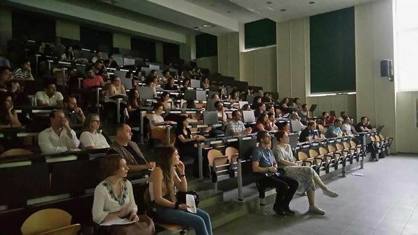
Agriculture has digital systems and must quickly start using them, according to Dionysios Kalyvas, Professor at the Agricultural University of Athens and organizer of the 3rd GIS and Spatial Analysis in Agriculture and the Environment Conference, which started on December 11. During the conference, an interesting study was presented, aiming to change the way we approach PDO zones.
Through the collection of thousands of data points, every inch of soil within 300,000 square meters in the Nemea area has been mapped over the last few years. Alongside this, meteorological data from 13 stations, satellite analyses, and additional data, such as the microbial load of the soil, were stored on the researchers' hard drives. It became evident that the zone is not a homogeneous area. For example, in two different points of the same zone, temperature differences of up to 10°C are recorded. Moreover, with planting line precision, the distinct imprint of the soil on wine during fermentation is visible.
In this context, the researchers argue that the zone model, “as we experienced it since the 1990s as a certification process, is outdated,” according to Euthymia Tsakalidou, Professor of Food Science at AUA, who participated with her team in the monumental scientific project, which is being implemented based on the standards established by similar research from UC Davis in California. It should be noted that these are the first findings, with the researchers striving to advance the research and committing to deliver a full server of data to the Nemea Wine Producers Association once the process is complete.
What the researchers highlight is the “gap” that the PDO model presents, i.e., the whole effort to sell an agricultural product with added value due to the special conditions prevailing where it was produced, making it stand out on the shelf. This happened either with unfair practices that "introduce" raw materials into the zone or with the inability of sub-zones to produce according to the standards of the broader zone.
“This research is not done purely out of scientific interest,” says Dr. Tsakalidou. “We are trying to highlight a tool for origin authentication and certification, so that the producer can confidently say, ‘this is my product.’” In this way, past certification issues are overcome, while at the same time, a new organoleptic fingerprint is defined in the final product, which could renew and enhance its commercial appeal.
The Agricultural University of Athens is serving the transition to digital spatial technology. Geographic Information Systems (GIS) and spatial analysis in general contribute to the creation of a green economy and sustainable development, with a focus on environmental protection, strategies increasingly adopted by companies both domestically and internationally.
A special session titled “Digital Agriculture (Spatially Defined): Education and Market Needs” will take place on the first day of the conference.
In the coming days, there will be scientific oral presentations on the following topics:
Soil and Water Resources – Land Evaluation
Web-GIS, Cloud Services, Satellite Data – Application Development
Protection of Animal – Plant Production (Pests – Diseases – Pathologies)
Spatial Digital Management of Farmlands
Spatial Analysis – Spatial DSS
Urban – Peri-urban Green
Natural Hazards – Natural Disasters, poster presentations, and educational workshops.
Read the article